Enhance autonomous testing with our precision simulation data. GeoMate's RealSimE integrates with leading platforms, providing authentic infrastructure intelligence for comprehensive virtual testing & validation.
Learn More
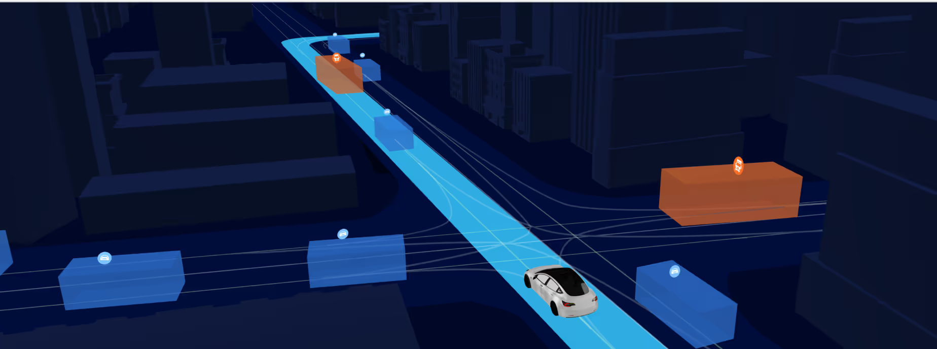
Our data supports autonomous mobility partners with essential infrastructure for virtual testing.
Autonomous Driving & Companies
Forward-thinking mobility developers integrate our simulation-ready data with their preferred testing platforms to validate system performance with authentic infrastructure information.
Simulation Solution Providers
Industry-leading technology partners enhance their simulation offerings by incorporating our high-precision infrastructure data, providing clients with real world map data testing fidelity.
Simulation Platforms
Testing ecosystems integrate our data to verify autonomous and driver assistance behavior throughout the development process with road infrastructure in different Operational Design Domains.
We can typically deliver complete mapping datasets for mid-sized cities in approximately 4 weeks, with smaller project areas available even faster.
This accelerated timeline is possible because our AI-powered approach eliminates the need for traditional field surveys, allowing us to process high-resolution imagery directly into actionable urban planning intelligence.
Unlike conventional mapping resources that often rely on outdated information or require extensive field verification, GeoMate provides 10cm-accurate, comprehensive urban datasets without any fieldwork.
Our AI algorithms capture and classify over 35 urban features automatically, delivering both greater detail and more current information than traditional GIS resources—at a fraction of the cost.
Our datasets provide the precise infrastructure mapping essential for 15-minute city planning, including complete sidewalk networks, bicycle pathways, micromobility corridors, and street connectivity analysis.
These comprehensive datasets enable planners to evaluate neighborhood accessibility, identify infrastructure gaps, and implement targeted improvements to ensure all residents can access essential services within a 15-minute walk or bike ride.
Absolutely. GeoMate delivers all datasets in standard GIS formats that seamlessly integrate with existing municipal systems, including direct compatibility with ESRI platforms.
Our data layers can be immediately incorporated into your current GIS environment without requiring specialized tools or conversion processes, ensuring a smooth workflow integration for planning departments.
Our specialized datasets provide the detailed infrastructure mapping critical for successful micromobility deployment, including comprehensive sidewalk networks, bike lanes, street furniture, and potential conflict points.
This intelligence enables planners to identify optimal routes, appropriate parking zones, and necessary infrastructure improvements—essential for creating safe, efficient micromobility systems that integrate harmoniously with existing transportation networks.
Learn More